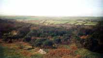
 These are Cornwall’s watery treasures and are largely a feature of the county’s geology and mild wet climate. The wild tor topped heights of Bodmin Moor, with its extensive areas of peat bog and clear feeder streams, is the source of many of the county’s principal rivers, the Fowey, Camel and De Lank, as well as the Ottery, Inny and Lynher which flow into the Tamar. The Camel system is designated as a Site of Special Scientific Interest (SSSI). The DeLank River is likely to receive further European recognition, by being added to the Natura 2000 list.
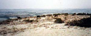
An intensification of farming since the war led by government has meant the drainage of large areas of wetland across the Duchy. This has been exacerbated by town and road drainage with increasing areas of land being lost under tarmac and concrete. Cornwall has little groundwater resources and so we are reliant on ‘surface’ storage, in particular wetlands, the most important being the sphagnum peat bogs of the high moor. These absorb rain as it falls particularly in winter and like a sponge and then release it gradually over time. Drainage programmes have made many of our rivers more susceptible to drought and ‘flashy’ floods. Both extremes have been very visible recently at a great cost to both the local communities and the environment.
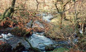
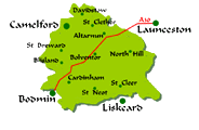
RIVER CAMEL |
|
Freshwater Fisheries The Rivers Camel and Allen have been consistently recorded as being amongst the most productive rivers for salmon and sea trout in the South West. This is due to a combination of high water quality, suitable habitats and sufficient water flows. Non-intensive use of land adjacent to the rivers throughout much of their length contributes to this high productivity. Perch, Rainbow Trout, rudd, roach and goldfish have also been found in the River Camel. Impact of Agriculture There is a high proportion of semi-natural habitat in the river corridor throughout the freshwater Camel and De Lank system. Semi-natural habitat is an indication of less intensive farming and permits more habitat for wildlife. The linking of habitats by corridors of semi-natural habitat allows movement of wildlife, as well as providing buffer zones between working agriculture and the river. Physical Characteristics The major river catchment is the River Camel draining an area of 413 square/km rising on Bodmin Moor joined by the River De Lank just below Poley’s Bridge (The start of the Camel Trail). The Camel flows over a distance of some 40km to Wadebridge and out into the estuary at Padstow. Conservation – Wildlife The Camel including the De Lank has been proposed as a Special Area of Conservation (SAC) as it contains significant numbers of otter and bullhead, (a small fish also known as the Millers Thumb), as well as a range of important rare habitats, high water quality and good fish stocks. The Rivers Camel, De Lank, Allen their tributaries and their associated unspoilt river corridors are of outstanding importance for wildlife. The area boasts pearl bordered fritillary butterflies, ancient woodland, a variety of river habitats, wet meadow, fen and heath. |
DE LANK RIVER |
|
The De Lank River features some of the most pristine habitats in Cornwall with outstanding water quality and a wealth of wildlife. Mining A walk along the De Lank River still reveals the remains of old tin mining streamworks. These can be found along much of its entire moorland length originally worked for tin lodes contained in its bed, banks and silts. Freshwater Fisheries Thousands of tonnes of granite from De Lank Quarry now occupying the rivers ancient channel prevent the free passage of migratory salmon and sea trout to the upper reaches of the De Lank River and prevent utilisation of a large area of potential spawning grounds in the rivers upper reaches. This has meant that the resident trout population in the river above the quarry obstruction is quite isolated. It is probable that these trout now represent a unique genetic type peculiar to the river. In 1998 the fresh carcass of a very large Brown Trout was found between Delphi and Bradford Bridges. Retrieved for post-mortem this fish was found to be a hen (female) of over 3 pounds in weight aged about 10 years old. These extraordinary fish are not common but neither are they exceptional. Impact of Recreational Activities Members of the public sometimes construct small dams on part of the De Lank during the summer months, where easily accessible parts of the river are popular with tourists. The removal of the larger stones from the riverbed deprives plants and animals of a micro-habitat. The use of turf exacerbates the erosion of the riverbank and contributes towards the siltation of the substrate. This seemingly innocent recreation could damage stretches of one of Cornwall’s most pristine river habitats. Conservation – Wildlife The proposed Camel SAC will include the De Lank River. The proposed SSSI includes the De Lank River which has been identified as an outstanding example its type. The De Lank is noted for its diverse and abundant flora and fauna. The invertebrate fauna is species rich, particularly in caddis. Nationally scarce species include the water beetle and the meniscus midge. Also of great importance are the many rare macrophytes present in the river and there is a noteworthy abundance and diversity of mosses and liverworts. The European Otter ~ Lutra lutra
|
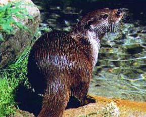 The River Camel and De Lank are an important stronghold for the otter one of Britain’s rarest and shyest mammals. Otters are regularly seen and travel the whole length of the river in their search for food, eels being their favourite prey. ‘Tarka’ the name given by Henry Williamson to the otter in his book of the same name means little wanderer. Indeed otters may travel 20 kilometres or more in a night. To cross from the North coast to the South coast otters will often use the river De Lank moving upriver until they find themselves at the source near the moors highest point at Brown Willy. From here it is a matter of crossing a couple of treacherous peat bogs and a short piece of open moorland of a few hundred metres taking them over the hill into the next catchment the source of the River Fowey.
Many thanks to the West Country Rivers Trust for all of the research on this page
| The Moors | |
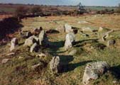
| The History of the Moors A brief outline of the history of Bodmin Moor from the Stone Age to present day |
 |
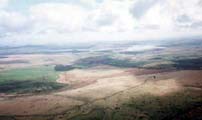 |
The landscape and features Indepth information about the landscape and the factors that have had shaped it, including a map of the key features |
| The Lords of the Manor All of Bodmin Moor is privately owned and the landowners are known as the 'Lords of the Manor'. Here is a detailed look into the history and their rights. |
 |
 |
Common Rights A detailed look at the history of the Rights of Common which have their roots in medieval times |
| The Parishes & Villages Histories, pictures and village pages for all the parishes on Bodmin Moor. |
 |
| Wildlife | |
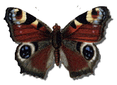
| Butterflies on Bodmin Moor Pictures of local butterflies and the times of year they can be seen |
 |
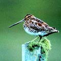 |
The Birds of Bodmin Moor Details of the RSBP survey on the birds of Bodmin Moor |
| The Bodmin Moor Pages | ||||
|---|---|---|---|---|
| Natural History | Heritage | Welcome | Parishes & Villages | Tourist Information |
 |
The Bodmin Moor Pages are brought to you by |
 |
||
| www.southpenquite.co.uk | ||||